

Tom Harrison Cartography
0 Viewers
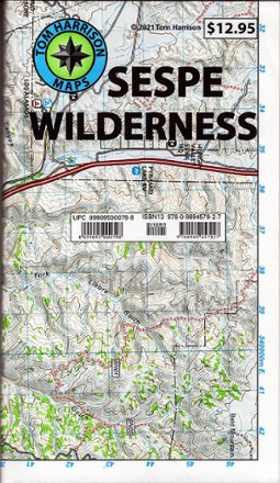
Sespe Wilderness Trail Map
We will deliver your goods as soon as possible
$12.95
Covers an area from Angeles National Forest through Matilija Wilderness to the West, where the Santa Barbara Coastal Range rises to about 7,000 ft.,Area includes the Sespe Condor Sanctuary,Area boundaries are well marked
About this product
Get into the Santa Barbara Coastal Range where condors soar with the Tom Harrison Cartography Sespe Wilderness trail map as your guide.
Features
- • Covers an area from Angeles National Forest through Matilija Wilderness to the West, where the Santa Barbara Coastal Range rises to about 7
- • 000 ft.
- • Area includes the Sespe Condor Sanctuary
- • Area boundaries are well marked
Specifications
| Best Use | Backpacking, Hiking |
|---|---|
| State / Province | California |
| Folded Dimensions | 7.5 x 4.25 inches |
| Unfolded Dimensions | 37.25 x 25.25 inches |
| Map Scale | 1:63,360 |
| Waterproof | Yes |
| Publisher | Tom Harrison Cartography |
| Copyright Year | 2021 |
Often bought with
$2080.00
Women's Norda 003, Black / 8.5


-51%

11.83 $24.00
Eve Light Weight Hiker Crew Socks - Women's
Sespe Wilderness Trail Map FAQs
Still have unanswered questions and need to get in touch?
Contact usRecipes

Blow-Up Tents Revolutionizing Camping with Effortless Setup and Comfort
Skills
|
Camping Gear

Bivvy Tents The Ultimate Minimalist Shelter for Lightweight Adventures
Skills
|
Camping Gear

Bikepacking Tents The Ultimate Shelter for Lightweight, High-Performance Adventures
Skills
|
Camping Gear


